Using LiDAR Technology to Preserve History

Mark Owings, AIA, LEED AP
Senior Vice President - ArchitectureIf you have thought about historic preservation, it was likely in the context of ensuring old buildings stay standing. As the desire to revitalize downtown areas becomes more popular, there is an increasing focus on the practical reasons to maintain detailed records of what exists now, what came before, and what is to come.
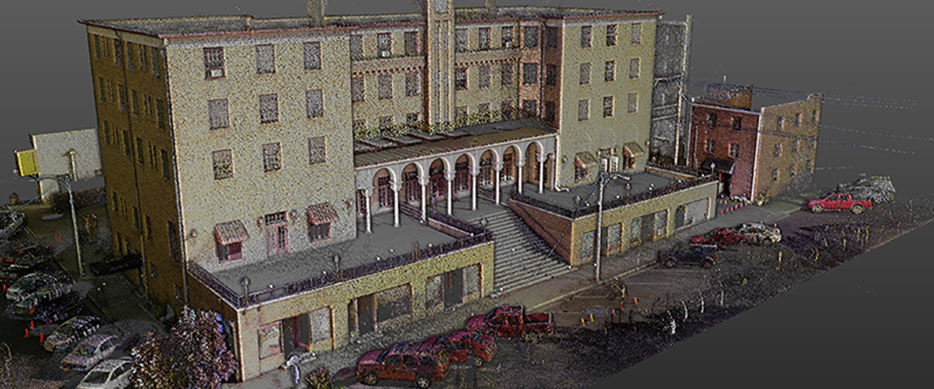
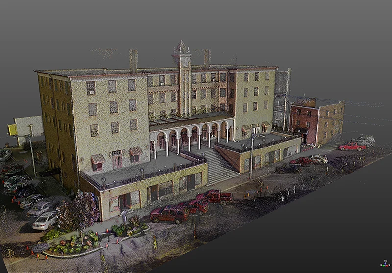
Most often, we use Light Detection and Ranging Scanning (LiDAR) to collect comprehensive data for 3D modeling, 3D inspection, and improved 3D asset management. LiDAR is a surveying method that uses laser technology to scan buildings and sites and creates a high resolution 3D digital model. As is often the case, new and innovative technology quickly breeds new and innovative ways to use it; historic preservation is one of those ways. Crafton Tull recently used LiDAR technology to scan the historic Lane Hotel building in downtown Rogers, AR. Once collected, the data was used by our architecture team to create a Building Information Model (BIM) to aid in the renovations from old hotel use to the new Haas Hall Academy.
Many cities may want to scan and model buildings for historical reference, while others may want to use the information in specific renovation projects. The Haas Hall project is a prime example of how to go about starting the process.
The Project
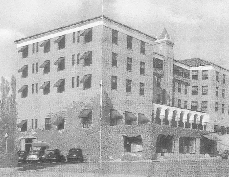
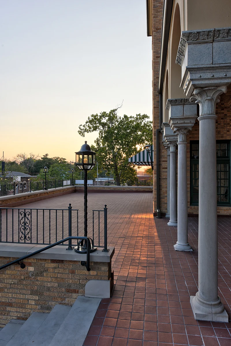
Built in 1928 in the Spanish Colonial style, the Lane Hotel is listed on the National Register of Historic Places and has an interesting past. After sitting vacant for many years, new investors purchased the building with the intent to renovate and restore the building and lease it to Haas Hall. Haas Hall Academy is a public open-enrollment charter high school with four campuses in Northwest Arkansas. The investors chose JKJ Architects to lead the renovation design of the historic building, and JKJ turned to CraftonTull to use LiDAR to scan the building and to create the 3D model that JKJ would use to design the renovations.
Photography: Brian Stark
The Process
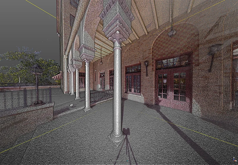
Prior to scanning, Crafton Tull staff visited the site with the client to determine the scope and timeframe. Once the scope was agreed upon, the scanning process began. After locating the starting point, the LiDAR crew made a series of scans around the exterior in a circular pattern, each scan adding to the previous one, and finishing back where the process began.
In addition to the exterior scans, certain interior rooms with unique architectural features were scanned to aid with the documentation of existing conditions and the renovation design. Using control points and scanning targets, Crafton Tull’s crew combined the outside and inside scans; this step is critical to eliminate errors and ensure that all of the data matches. It took two days to scan the entire exterior and the main-entrance areas of the interior. It is not always necessary to gather this amount of data, but doing so allowed the attention to detail required for this particular historical renovation project.
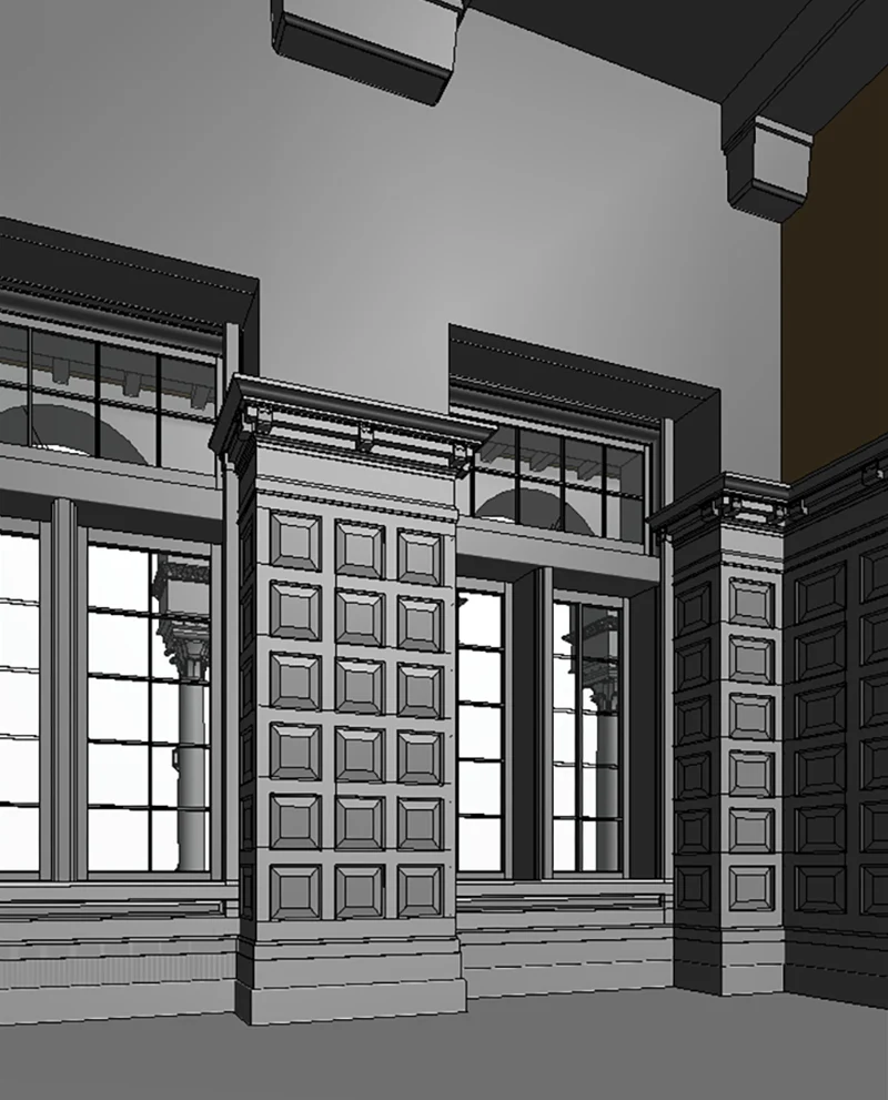
When the fieldwork was finished, the data was processed into a contiguous point cloud model of the entire project. Finally, after verifying the data and removing anything non-pertinent, the Crafton Tull survey staff provided our architects the raw point cloud format classified into regions. In addition, our staff created a virtual tour of the property that allowed for annotation and an Autodesk Recap project for use in Revit or AutoCAD software for modeling of the existing building and site conditions for historic preservation.
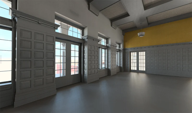
The Crafton Tull architecture team began recreating the existing building model using Autodesk ReCap software to view the point cloud data. The level of detail from the laser scan allowed the architects to model everything from the wood paneling to the beams and brackets in the ceiling, which they later used to create 3D panoramas for the client to view with Google Cardboard Virtual Reality (VR) glasses.
Photography: Brian Stark
The Benefits
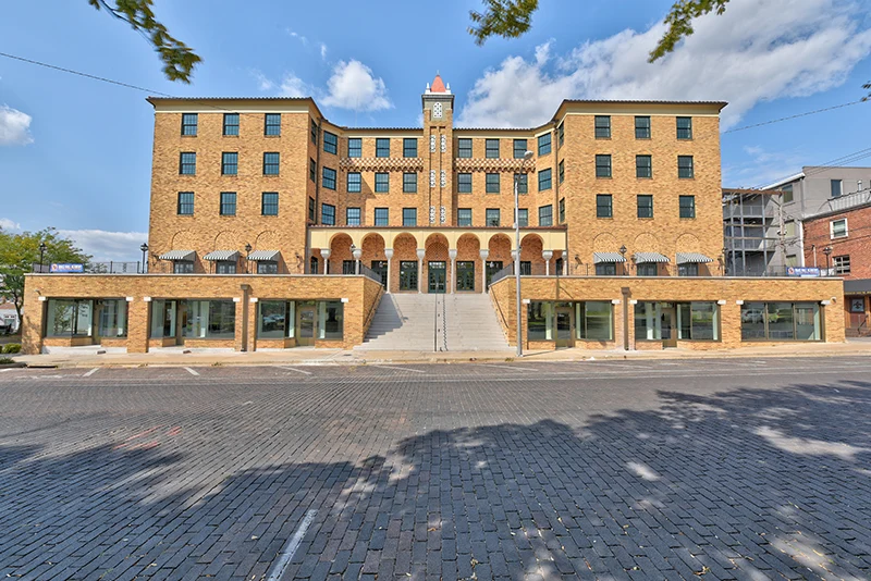
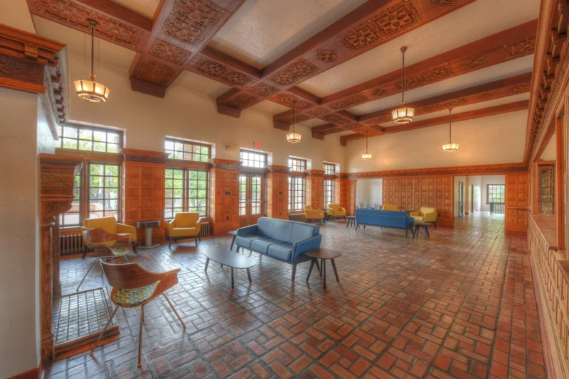
The Haas Hall project proved to be a massive success upon opening to students in August of 2017. One important takeaway is the potential benefits this technology can provide other cities looking to renovate, restore, or document existing landmarks. 3D scanning makes it possible for one technician to collect the same amount of data in less than two days which would have previously taken a team of technicians using traditional methods the better part of a week to gather. LiDAR allows the capture of full 3D “pictures” of existing buildings in unprecedented detail at a particular moment in time. Reducing the time spent on site lessens the impact on the daily flows at the building, lowers client costs, and provides direct insight into the location for designers or historians without the need to be there. The scans capture hundreds of millions of points, each with its xyz value in relation to each other, providing amounts of data unparalleled to conventional methods. Clients and design teams can virtually step into their projects without even making a site visit.
Photography: Brian Stark
We pride ourselves on keeping up with the latest technological advancements in our field. Because we are continually learning about innovative uses for existing technology, our professionals jumped at the opportunity to apply our technical capabilities in a new way. Crafton Tull began with a tape measure and a field book, and we believe there is still a place for the tried and true methods. However, our experience shows that foundational knowledge, combined with training and new technology, takes building design into the future.