Solving the Mystery of Underground Utilities

Michael Williams, P.E.
Vice President - Infrastructure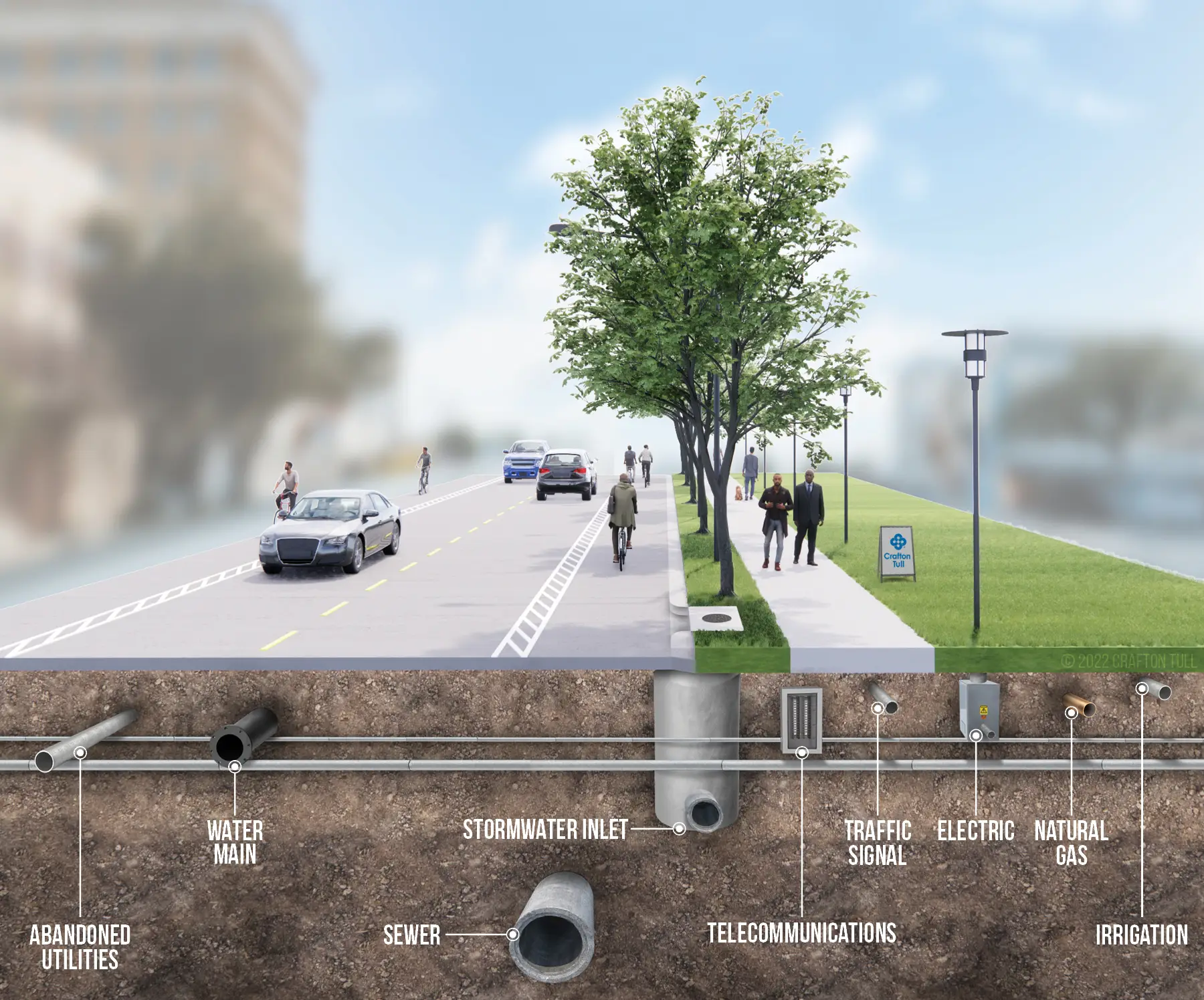
Moving utilities is costly. Designers typically make every effort to avoid them. A roadway alignment shifted by a few feet could save the hassle of costly and lengthy utility relocations. If new construction will require right-of-way acquisition, then adequate room must be planned to allow room for utilities.
Precision is the goal of every engineering project, but calculations used in the design process are only as good as the data provided.
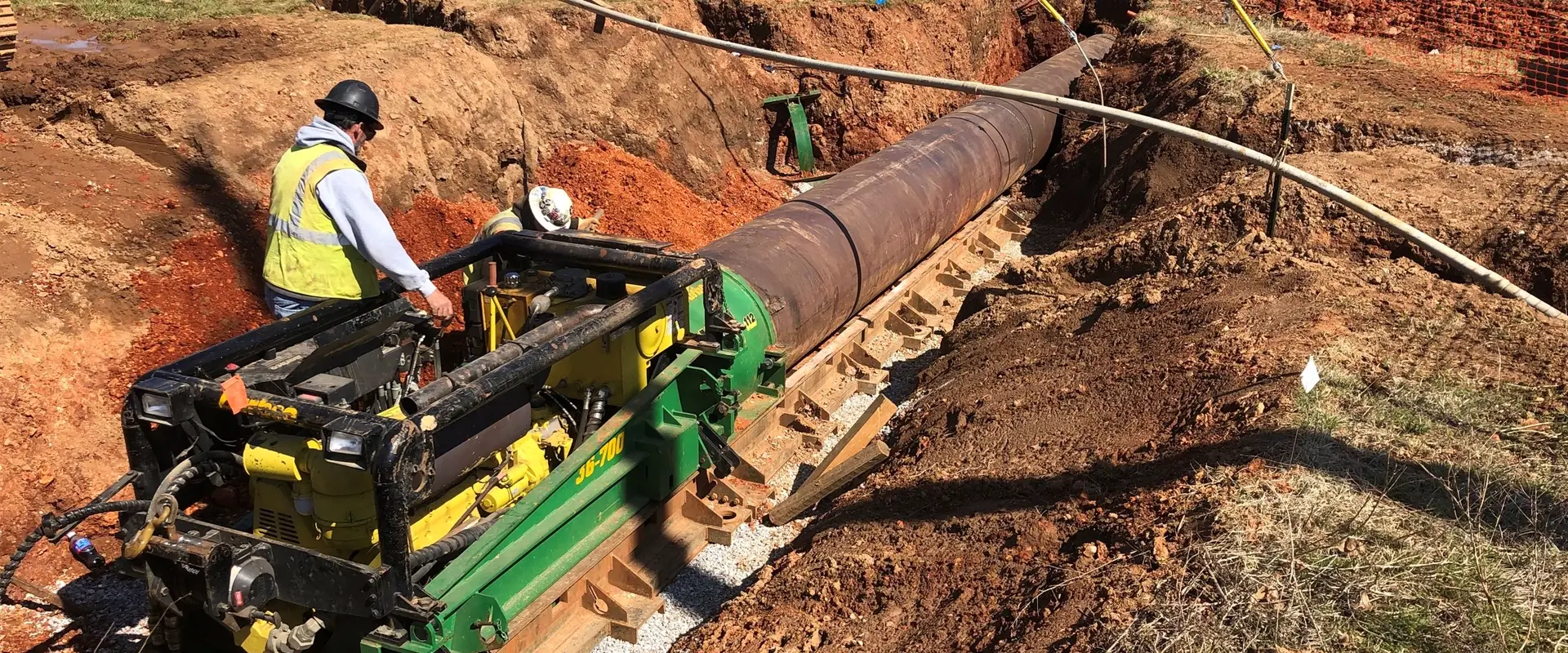
Potholing, or digging a hole to visually inspect utilities early in the design process, can prevent interruptions in critical services, cost overruns and safeguard the public and contractors from hazardous gas and electric lines. Accurate data from potholing keeps a project on time and on budget.
Repairs to utilities damaged during construction cost an estimated $30 billion annually. Plus, bond issues often have target construction dates and with recent fluctuations in material costs and availability, it is important that projects hold to an established timeline to maintain public trust.
It is standard practice to call for utility location to be marked by paint, flags, or stakes early in a project. This can give designers an idea — but not a full picture — if a utility will be close to the project. Line markers can point to what is underground, or there may be clues like a manhole for sanitary sewer or valves for waterlines.
Surveyors locate utilities based on these visual cues and the areas flagged or marked. The project is designed around those measurements. However, surveyors are measuring what they can see. And they cannot measure utility depth, but only map the x and y coordinates. A waterline that is supposed to be 36” deep could have had soils built up over time in progressive development. Without inspection, city engineers will be guessing as to the condition and approximate location of those underground utilities. Underground lines may be long abandoned and undocumented. Original plans may be well documented, but the utilities themselves not installed according to plan.
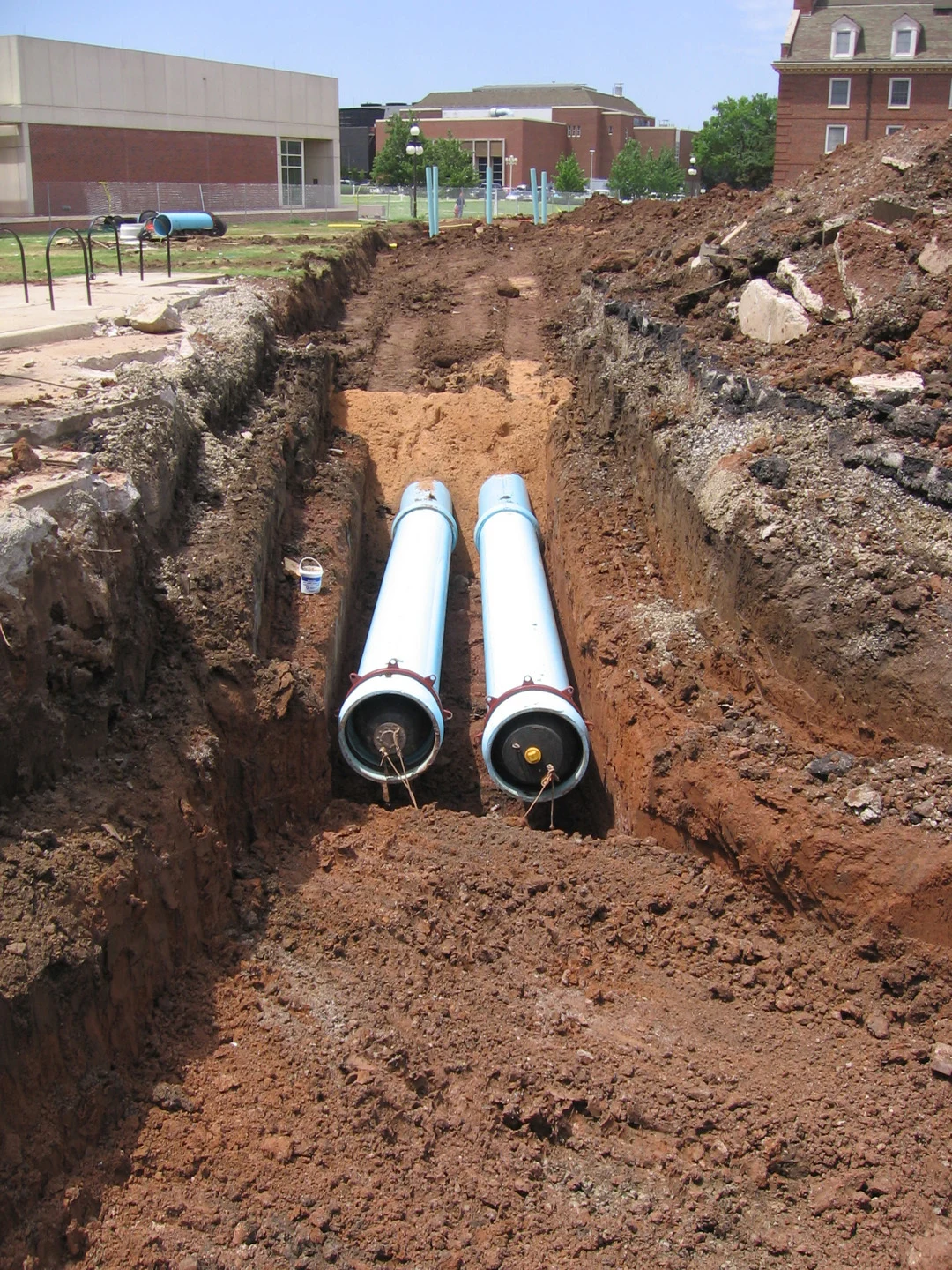
Exposing and visually inspecting these utilities in the design phase will make construction proceed more smoothly. There is more than one way to expose the underground utilities. If utilities are in a tight area, and close to the surface, hand digging is an option for potholing. Vacuum / Hydro excavation prevents disruption to utilities and uses air or water to disrupt and remove the soil. Ground Penetrating Radar can be used as an additional tool before potholing to create a more accurate location. The key to a well-thought-out design is locating the underground utilities and preventing unforeseen cost and delays during the construction process.
Full Subsurface Utility Engineering (SUE) was introduced in the 1990s. This process looks at four levels of data starting with existing records, surveying and plotting, geophysical location and then potholing along the project route.
It is best practice to have a thorough understanding of underground utilities. Prioritizing a project for potholing can be based on the concentration of underground utilities, age of available data, how close utilities are believed to be to the project, and the sheer importance of what lies below. Some utilities are too deep, and too costly to move without strong justification. Or perhaps the kind of project demands better data, such as a sanitary sewer pipe bursting project near a buried high-voltage electrical line.
Even if a project doesn’t merit the full SUE process, potholing early in the design phase to locate high-risk utilities or critical underground infrastructure typically costs only a few hundred dollars extra and can save relocating or redesigning an entire project after construction begins.
Utility marks are requested through a One Call number such as Arkansas 811 or Okie811 with an estimated 273.9 million such requests in 2020. However, failure to test the marked utilities was the second leading cause of all reported damage in 2020.
Failure to test location marks through potholing can be costly. Accurate utility data and smart pre-planning can prevent costly delays and make the construction process smoother, and ultimately a better infrastructure project.